Map of old Dutch Warship (Dutch man-o-war) 1720
Johann Baptist Homann
PaperPrint
50 ⨯ 59 cm
€ 1.350
Inter-Antiquariaat Mefferdt & De Jonge
- About the artwork“Neue Tafel vor alle Liebhabers und See-fahrende Personen stellet vor ein Orlog oder Kriegs-Schiff mit seinen volligen Tow & Seil Werck Sampt einen Durchgeschnittenen Schiff, auch vor und Hindertheil Desgleichen Booten Chaloupen und Schiff-Heber, nebst noch mehr anderer Schiffs Geraeth-schafft und Zugehörungen” [New Plate for all Admirers and seafaring Persons, depicting a Man-of-War or Warship with Its complete Rigging and Ropery, together with a Cutaway View of the Ship, Its fore and aft Sections, as well as Boats, Shallops and Ship Camel, along with various other Nautical Equipment and Accessories.] Copper engraving published by Johann Baptist Homann in Nuremberg, c. 1720. Coloured by a later hand. Size: approx. 50 × 59 cm. Cross-section of a fully rigged three-masted warship with 96 cannons, surrounded by various types of ship hulls. Rich in detail, with explanations of the nautical instruments used. The hierarchy on board is also meticulously listed—from the highest officer (Admiral-General) to the lowest servant (soldiers). Price: Euro 1.350,-
- About the artist
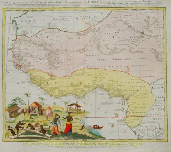
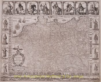
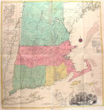
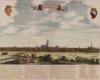
Johann Baptist Homann (1664–1724) was a leading German cartographer, engraver, and publisher of the early 18th century, widely regarded as one of the most influential mapmakers of his time. Born in Oberkammlach in Bavaria, he was initially educated at a Jesuit school before converting to Protestantism—a decision that would shape both his personal and professional path.
Homann began his career as a notary in Nürnberg in 1687, but soon shifted his focus to engraving and cartography, driven by a growing interest in geography and the visual representation of knowledge. After a formative period in Vienna between 1693 and 1695, he returned to Nürnberg, where he founded his own publishing house in 1702. This marked the beginning of a highly productive and influential career.
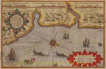
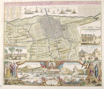
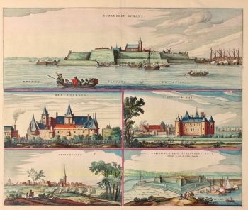
His maps quickly gained recognition for their precision, clarity, and decorative richness, combining scientific rigor with elaborate baroque ornamentation. Homann’s reputation led to his appointment as Imperial Geographer by Emperor Charles VI in 1715, and he was later elected to the Prussian Academy of Sciences in Berlin—an acknowledgment of his contribution to the advancement of geographic knowledge.
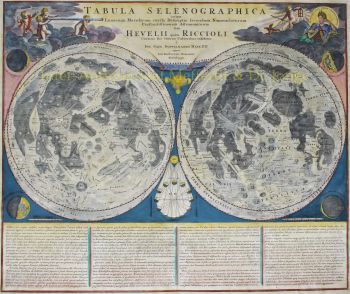
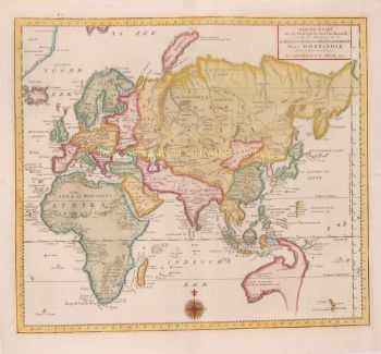
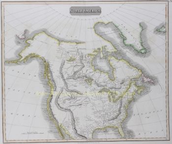
In 1716, Homann published his most renowned work, the Grosser Atlas über die ganze Welt (Grand Atlas of all the World), a comprehensive and ambitious collection of maps that consolidated his legacy. Many of these works were created in collaboration with engraver Christoph Weigel the Elder. Through his publishing house and cartographic output, Homann played a central role in establishing Nürnberg as a major center of map production in Europe.
Are you interested in buying this artwork?
Artwork details
Related artworks
- 1 - 4 / 5
Vincent Laurensz van der Vinne
Portrait of a man and woman1640 - 1650
Price on requestArt Gallery Voûte
Unknown artist
Een Gotische zuidelijke Nederlanden wandklok1580 - 1590
Price on requestNico van den Assem restauratie
1 - 4 / 24- 1 - 4 / 24
Cornelis Anthonisz Theunissen
VERY RARE FIRST PRINTED MAP OF AMSTERDAM, A CITY ON THE RISE1544
€ 125.000Inter-Antiquariaat Mefferdt & De Jonge
Curated byDanny Bree
1 - 4 / 24- 1 - 4 / 24
- 1 - 4 / 12


