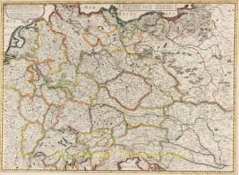
Antique Germany map 1626
Johannes Janssonius
€ 5.500
Inter-Antiquariaat Mefferdt & De Jonge
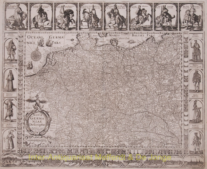
- About the artworkAntique Germany map - Nova Germaniae Descriptio Beautiful map of greater Germany. 2nd state (out of 5) published in 1626 by Johannes Janssonius, originally published by Petrus Kaerius in 1615. Size: 47 x 57,2 cm. The map is framed on all sides with decorative borders. The top border contains portaits of Emperor Matthias with the seven Electors, all on horseback. Matthias is shown twice: as emperor and as king of Bohemia and Hungary. On three sides the map image is framed by shields with coats of arms. Along the bottom border runs a strip with ten town views in oval frames: Cologne, Frankfurt, Strassbourg, Nurenberg, Prague, Augsburg, Hedeilberg, Lübeck and Hamburg. Willem janszn.'s map of 1609 served as a model for the town views. The coats of arms along the side borders are flanked by costumed figures. Verso: blank. Literature: Günther Schilder, Monumenta Cartographica VI, 33.2 Price: Euro5.500,- (excl. VAT/BTW)
- About the artist
Janssonius was born in Arnhem as the son of Jan Jansz, a printer and publisher there. At a young age he moved to Amsterdam, the then center of the printing and card trade. In 1612 he married Elisabeth Hondius, daughter of Jodocus Hondius. Elisabeth died in 1627 and Janssonius remarried in 1629 with Elisabeth Carlier. He went to work for his father-in-law and continued the publishing business together with Henricus Hondius (son of) after his death. This was developed into one of the largest of its time. There were branches in Berlin, Frankfurt, Geneva, Lyon and Stockholm, among others.
Under Janssonius' leadership, the Mercator-Hondius Atlas was expanded and published as Atlas Novus. This initially one-volume edition soon became a multi-volume atlas, supplemented on request with nautical charts and/or celestial charts. There were publications in Dutch, French, Spanish and Latin. Like his contemporaries, Janssonius also made use of existing copper plates, including those from the city books of Braun & Hogenberg and the Description de touts les Pays Bas (Description of all the Netherlands) by Lodovico Guicciardini - (Cornelis Claesz. edition) from 1609 Although Janssonius has often been accused of copying Willem Blaeu's work, it may be noted that maps by Janssonius also appeared on the market earlier.
After Janssonius' death, the firm was continued by his son-in-law, Johannes (Jan) van Waesbergen, who was married to his daughter Elisabeth Janssonius (1615-1681). Many copper plates of the city books were used (sometimes slightly modified) by Frederik de Wit. The building on Dam Square was leased to Gerard Valck; He also bought a number of printing plates in 1694.
Are you interested in buying this artwork?
Artwork details
Related artworks
- 1 - 4 / 4
- 1 - 4 / 24
- 1 - 4 / 12

