Joan Blaeu (1596-1673), werd geboren op 23 september 1596 in Alkmaar.
Hij was een Nederlandse cartograaf geboren in Alkmaar. Hij trad in de voetsporen van zijn vader, cartograaf Willem Blaeu.
In 1620 werd hij doctor in de rechten, maar hij sloot zich aan bij het werk van zijn vader. In 1635 publiceerden zij de Atlas Novus (volledige titel: Theatrum orbis terrarum, sive, Atlas novus) in twee delen. Joan en zijn broer Cornelius namen het atelier over na het overlijden van hun vader in 1638. Joan werd de officiële cartograaf van de Verenigde Oost-Indische Compagnie.
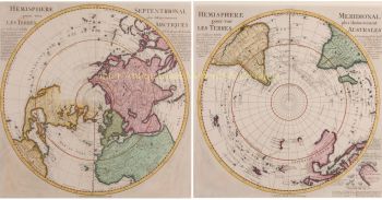
Blaeu's wereldkaart, Nova et Accuratissima Terrarum Orbis Tabula, waarin de ontdekkingen van Abel Tasman zijn verwerkt, werd gepubliceerd in 1648. Deze kaart was revolutionair omdat hij "het zonnestelsel weergeeft volgens de heliocentrische theorieën van Nicolaus Copernicus, die laten zien dat de aarde ronddraait de zon .... Hoewel het baanbrekende boek van Copernicus On the Revolutions of the Spheres voor het eerst werd gedrukt in 1543, iets meer dan een eeuw eerder, was Blaeu de eerste kaartenmaker die deze revolutionaire heliocentrische theorie op een wereldkaart verwerkte.
Blaeu's kaart werd gekopieerd voor de kaart van de wereld in de stoep van de Groote Burger-Zaal van het nieuwe Amsterdamse stadhuis, ontworpen door de Nederlandse architect Jacob van Campen (nu het Koninklijk Paleis Amsterdam), in 1655.
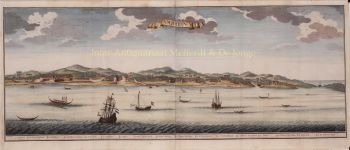
Blaeu's Hollandia Nova werd ook afgebeeld in zijn Archipelagus Orientalis sive Asiaticus, gepubliceerd in 1659 in de Kurfürsten Atlas (Atlas van de Grote Keurvorst). en gebruikt door Melchisédech Thévenot om zijn kaart Hollandia Nova - Terre Australe (1664) te produceren.
Als "Jean Blaeu" publiceerde hij ook het 12e deel "Le Grand Atlas, ou Cosmographie blaviane, en laquelle est exactement descritte la terre, la mer, et le ciel". Eén uitgave dateert uit 1663. Dat was folio (540 x 340 mm) en bevatte 593 gegraveerde kaarten en platen. In maart 2015 was een exemplaar te koop voor £ 750.000.
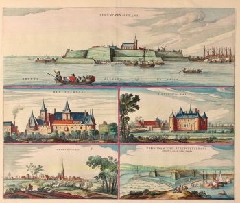
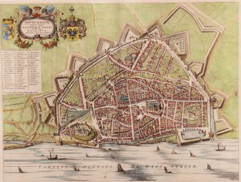
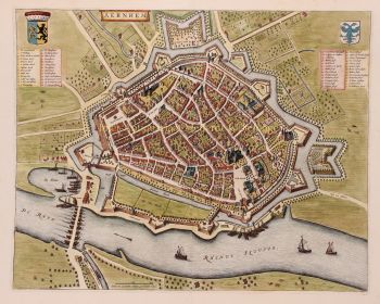
Rond 1649 publiceerde Joan Blaeu een verzameling Nederlandse stadsplattegronden genaamd Toonneel der Steeden. In 1651 werd hij in de Amsterdamse gemeenteraad gestemd. In 1654 publiceerde Joan de eerste atlas van Schotland, bedacht door Timothy Pont. In 1662 bracht hij de Atlas Novus, ook wel bekend als Atlas Maior, opnieuw uit in 11 delen en één voor oceanen.
Een kosmologie was gepland als hun volgende project, maar een brand verwoestte de studio volledig in 1672.
Joan Blaeu stierf in Amsterdam het volgende jaar, 1673. Hij werd begraven in de Westerkerk in Amsterdam.