China  by Covens and Mortier
Scroll to zoom, click for slideshow

China 1695

Covens and Mortier

InktPapier
46 ⨯ 59 cm
€ 1.450

Inter-Antiquariaat Mefferdt & De Jonge

  • Over kunstwerk
    “Imperii Sinarum Nova Descriptio” [The Chinese Empire newly described]. Copper engraving published by Johannes Covens and Pieter Mortier around 1695. Verso: blank. Coloured by a later hand. Size: 46 x 59 cm. This great map of the Chinese Empire was based on the compilation of the Jesuit father Martino Martini who traveled through the region between 1643 and 1650. Martini was the Jesuit Superior in Hangchow, giving him access to indigenous and Jesuit surveys of all the regions of China. It was a period of great internal unrest and his was a perilous journey. He was able to travel inland to the Great Wall and for the first time determined with any scientific accuracy the astronomical position of many cities and topographical features. After establishing a mission in Zhejiang province he returned to Rome via Amsterdam, where he met publisher Joan Blaeu. Blaeu then prepared a group of eight maps covering China in great detail for the “Atlas Sinensis”, the first western atlas of China China is mapped with considerable accuracy for the period: the Great Wall is shown. The map incorporates the discoveries of Joao da Gama and Maarten Gerritsz de Vries. Korea for the first time on a European map is no longer depicted as an island but as a peninsula. The depiction of Japan follows a Portugese map by Christopher Blancus and Ignacio Moreira from 1617, but it is the first map to name and show Hokkaido (here “Ieso”) as an island to the north of Honshu. The map was first issued by Joan Blaeu, and then part of the plates acquired by Covens & Mortier at the end of the 17th century and re-issued with a new privilege by the Covens & Mortier firm. Price: Euro 1.450,-
  • Over kunstenaar

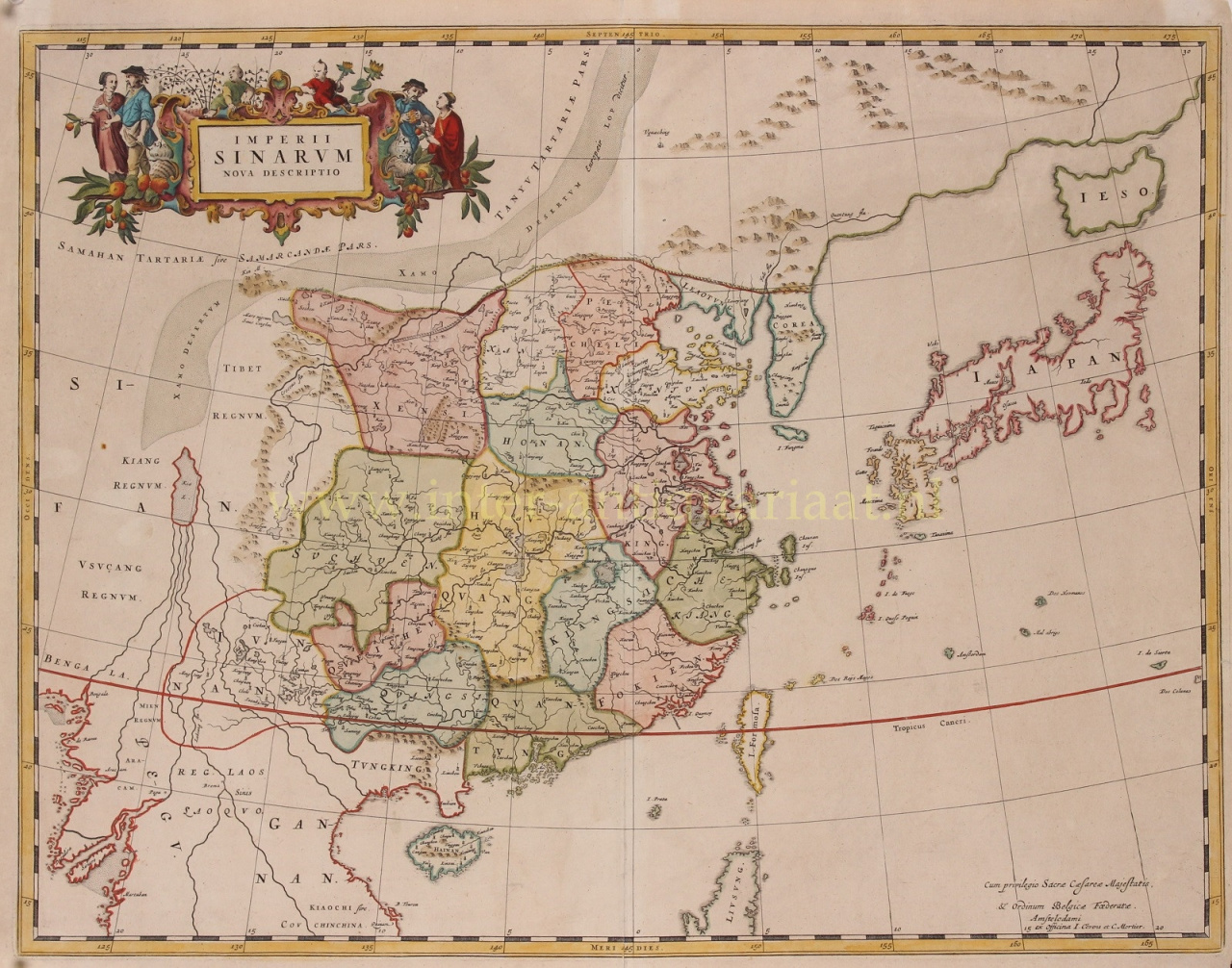
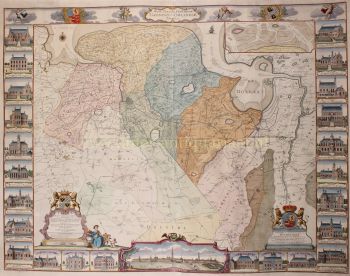
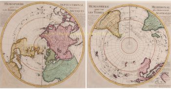
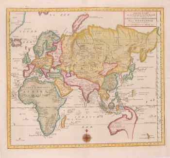
    Covens en Mortier (1721 - ca. 1862) was een Amsterdamse uitgeverij, de opvolger van het omvangrijke uitgeverij-imperium dat door Pierre Mortier (1661 - 1711) was opgebouwd.

    De kaart van Covens en Mortier wordt vaak bekritiseerd als afgeleide, maar dit is niet helemaal het geval. Pierre Mortier woonde van 1681 tot 1685 in Parijs. Daar bouwde hij hechte relaties op met de grootste Franse cartografen van die tijd, waaronder De L'Isle en D'Anville.

    Zijn bedrijfsmodel was gebaseerd op het benutten van Nederlandse printtechnologie en verfijning om samen de allernieuwste Franse cartografie te publiceren. Na de dood van Mortier in 1711 werd zijn bedrijf overgenomen door zijn zoon, Cornelius Mortier (1699 - 1783). Cornelius trouwde in 1721 met de zus van Johannes Covens (1697 - 1774) en richtte samen met zijn zwager de firma Covens and Mortier op.

    Onder de afdruk van Covens en Mortier gingen Cornelius en Johannes door met het model van Pierre om met toestemming de meest actuele Franse werken te publiceren. Ze werden al snel een van de grootste en meest productieve Nederlandse uitgeverijen van de 18e eeuw.

    Het bedrijf en zijn opvolgers publiceerden duizenden kaarten over een periode van 120 jaar van 1721 tot het midden van de 19e eeuw. Tijdens hun lange bestaan publiceerde de firma Covens and Mortier als Covens and Mortier (1721 - 1778), J. Covens and Son (1778 - 94) en Mortier, Covens and Son (1794 - ca. 1862).

Bent u geïnteresseerd om dit kunstwerk te kopen?

Artwork details

Categorie
Onderwerp
Materiaal & Techniek