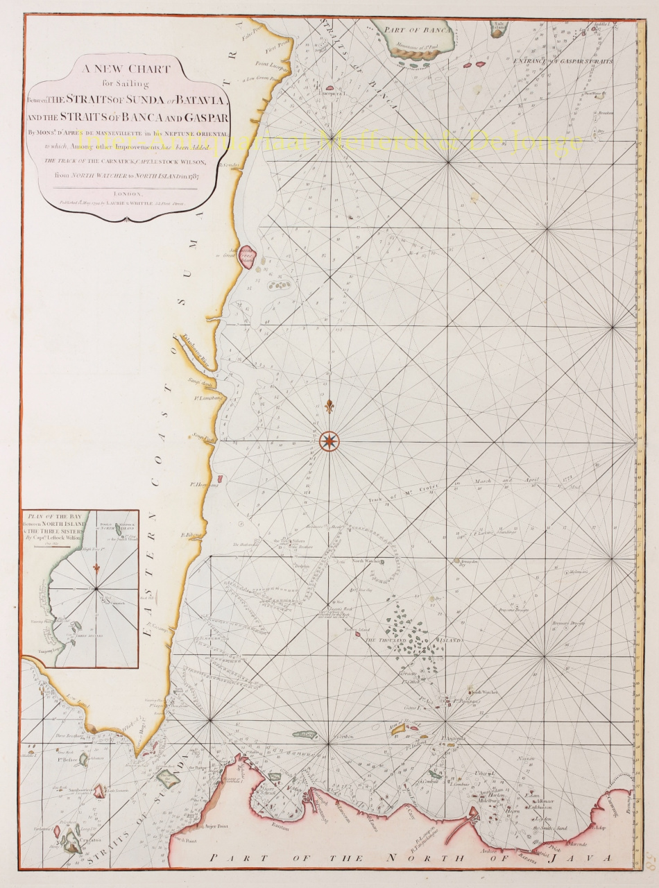
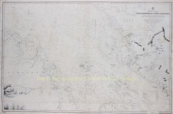
INDONESIA NAUTICAL CHART "A New Chart for Sailing between the Straits of Sunda or Batavia and the Straits of Banca and Gaspar." Copper engraving from "The East-India Pilot, or Oriental Navigator" published in London by Robert Laurie and James Whittle in 1794. Coloured by a later hand. Size: 50,8 x 68,6 cm. Nautical chart of northwestern Java and eastern Sumatra, including the Straits of Sunda and the Strait of Banca. The map covers from the Strait of Banca southwards to the Krakatoa volcano, the east as far as Batavia (Jakarta). Throughout the 17th and 18th centuries, this region was a major battleground between rival Dutch, British, and Portugese trading monopolies. The Dutch and British in particular contested over northwestern Java, with its easy access to regional spice, in particular pepper, ports. In 1602 the British East India Company established a trade entrepot at Bantam to contest the Dutch East India Company (VOC) in nearby Batavia. The Dutch, allied with a local Sultan, eventually drove the English out of Bantam and Java itself. By the end of the 18th century, when this map was made, the Bantam entrepot was little more than a name on a map - as seen here - while Batavia further east had risen, with a population of nearly one million, to dominate Java. In 1800, just six years after this map was published, the VOC was formally dissolved and the Dutch East Indies established in its place as a full-fledged national colonial venture. The British meanwhile established themselves in Bencoolen, on Sumatra, and later in Singapore and Malacca. Cartographically this chart is derived from earlier maps prepared for Jean-Baptiste d'Apres de Mannevillette's 1745 Neptune Oriental. It was subsequently updated and revised under Laurie and Whittle based on charts compiled by Captain Lestock Williams. The map offers rich detail including countless depth soundings, notes on the sea floor, commentary on reefs, rhumb lines, shoals, place names and a wealth of other practical information for the mariner. Price: Euro975,- (excl. VAT/BTW)