Achterhoek (County of Zutphen) 1641
Johannes Janssonius
€ 295
Inter-Antiquariaat Mefferdt & De Jonge
- About the artwork
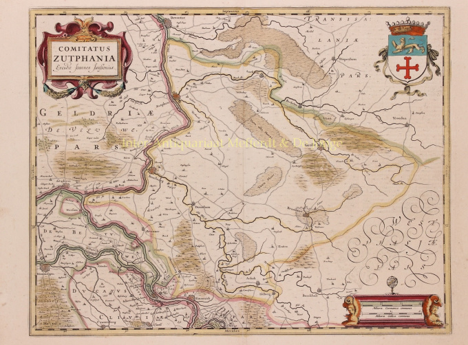
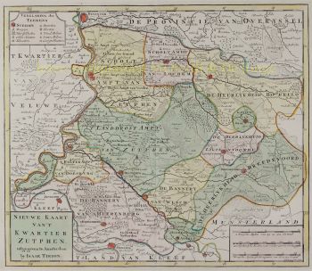
THE QUARTER OF ZUTPHEN "Comitatus Zutphania", copper engraving published by Johannes Janssonius in 1641 as part of his "Nouveau Theatre du Monde ou Nouvel Atlas". Coloured by hand at the time. Measures 46.5 x 56.4 cm. In the years 1557 to 1559 the area was mapped by Christiaan sGrooten. sGrooten's map of Gelderland was also the model for Janssonius' map of the County of Zutphen. We see the Kleef area near Huissen and Zevenaar clearly delimited. Isselburg falls within the border of the County. There are no siege works drawn around Groenlo. The area of the manor of Borculo fell under the Earldom after 1615, but is shown here as part of the Bishopric of Münster. For the city of Zutphen, the Eighty Years' War brought difficult times. In 1572, Zutphen was captured by William of Orange's brother-in-law. The Spaniards were driven out, but half a year later they took the city back and executed hundreds of inhabitants. In 1577, the Spaniards left the city, but the Catholic city council remained in place. In the summer of 1579, the Protestants seized power and deposed the Roman Catholic administrators. In 1583, Zutphen was again in the hands of the Spaniards but after that, the city was besieged two more times by the Staatsen. In 1591, Prince Maurits conquered Zutphen until, in 1629, a German-Spanish army once again invaded the Veluwe and went on a killing spree. Top right, the city arms of Zutphen are depicted, with the Count's Crown on top. Bottom right the scale of the map is flanked by winged angels with claws, on top is an armillary as a symbol of wisdom and knowledge (of the mapmaker). Price: Euro 295,-
- About the artist
Janssonius was born in Arnhem as the son of Jan Jansz, a printer and publisher there. At a young age he moved to Amsterdam, the then center of the printing and card trade. In 1612 he married Elisabeth Hondius, daughter of Jodocus Hondius. Elisabeth died in 1627 and Janssonius remarried in 1629 with Elisabeth Carlier. He went to work for his father-in-law and continued the publishing business together with Henricus Hondius (son of) after his death. This was developed into one of the largest of its time. There were branches in Berlin, Frankfurt, Geneva, Lyon and Stockholm, among others.
Under Janssonius' leadership, the Mercator-Hondius Atlas was expanded and published as Atlas Novus. This initially one-volume edition soon became a multi-volume atlas, supplemented on request with nautical charts and/or celestial charts. There were publications in Dutch, French, Spanish and Latin. Like his contemporaries, Janssonius also made use of existing copper plates, including those from the city books of Braun & Hogenberg and the Description de touts les Pays Bas (Description of all the Netherlands) by Lodovico Guicciardini - (Cornelis Claesz. edition) from 1609 Although Janssonius has often been accused of copying Willem Blaeu's work, it may be noted that maps by Janssonius also appeared on the market earlier.
After Janssonius' death, the firm was continued by his son-in-law, Johannes (Jan) van Waesbergen, who was married to his daughter Elisabeth Janssonius (1615-1681). Many copper plates of the city books were used (sometimes slightly modified) by Frederik de Wit. The building on Dam Square was leased to Gerard Valck; He also bought a number of printing plates in 1694.
Are you interested in buying this artwork?
Artwork details
Related artworks
- 1 - 4 / 4
- 1 - 4 / 24
- 1 - 4 / 12

