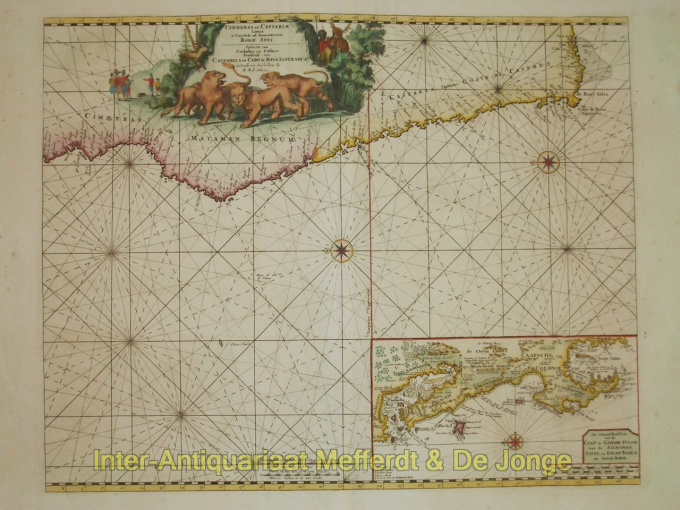
Zuid-Afrika, Kaap de Goede Hoop 1680
Reinier & Joshua Ottens
€ 825
Inter-Antiquariaat Mefferdt & De Jonge
- About the artworkZEEKAART VAN DE KUST VAN ZUID-AFRIKA MET KAART DE GOEDE HOOP "Cimbebas et Caffariae Littora a Catenbela ad Promontorium Bonae Spei". Kopergravure vervaardigd ca. 1680 door Reinier en Josua Ottens. In de tijd met de hand gekleurd. Afmetingen: 43,5 x 55 cm. We zien de kustlijn van Zuid-Afrika ten westen van Kaap de Goede Hoop. Op deze zeekaart ligt het Noorden links. In het grote cartouche staan leeuwen en luipaarden afgebeeld, evenals Europeanen die met Afrikanen onderhandelen. De inzet toont de ommelanden van de Kaap de Goede Hoop. Prijs: Euro825,- (excl. BTW/VAT)
- About the artist
The period from 1630 to 1700 was the "golden age" of Dutch cartography. The maps were perceived as works of art, manual work was highly valued, engraving was at the highest level, but from the point of view of the geographical accuracy, maps of Dutch masters were inferior to maps produced in Germany, France and other European countries.
Joachim, the founder of the Ottens firm, was born in Amsterdam and initially worked as a copper engraver. In 1711 he founded his own firm engaged in publishing and printing business, selling books, maps, postcards and illustrating them.
Although Joachim died a few years later, his sons, Renier and Joshua, successfully continued their father's business. The most significant contribution to the cartography of the Ottens family was the huge multivolume atlases they made to order, such as Atlas Major. Some Atlas issues are composed of more than 800 separately issued maps.
Are you interested in buying this artwork?
Artwork details
Related artworks
- 1 - 4 / 4
- 1 - 4 / 24
- 1 - 4 / 12

