World map  by Covens and Mortier
Scroll to zoom, click for slideshow

Mapa mundial 1745

Covens and Mortier

€ 2.250

Inter-Antiquariaat Mefferdt & De Jonge

  • Sobre arte
    Mappe-Monde Dressé sur les Observations de Mrs. De L'Academie Royale des Sciences et quelques autres et sur les memoires les plus recens Par M. De L'Isle. Copper engraving published by Covens & Mortier in Amsterdam 1745. Coloured by a later hand. Size: 50,8 x 63,5 cm. Guillaume De L'Isle's world map was originally published in 1700 and then revised and republished throughout the 18th century by De L'Isle and by subsequent map publishers. Dutch publishers Covens & Mortier's first version of De L'Isle's map was produced in 1720 adding the seascape with ships on the horizon at the bottom decorated with a second cartouche in the shape of a sea monster with a mermaid, merman and dolphins. They issued a later edition of that map (shown here) in about 1745 with the additional subtitle "Nouvellement corrigée apres les dernieres Decouvertes faites par l'Academie de Petersbough." The map consists of two central hemispheres, eastern and western, surrounded by four smaller polar projections. The right hand projections focus on the Northern Hemisphere while the left hand projections depict the Southern. At top center there is an elaborate decorative cartouche with various allegorical elements depicting the four great continents in female form, from top left: America, Europa, Africa, and Asia. The routes of a number of the most famous explorers of the major oceans of the world are shown from 1542 to approximately 1730, ending with the Russian voyages of Chirikov and Bering. Some of the more noteworthy features of the map includes the Russian explorations along the Northwestern coast of America, Aleutian islands shown in a semi-mythical configuration and attached to a highly conjectural Alaska; Edmund Halley's sighting of Antarctic ice; Bouvet's large Cap de la Circoncision; A depiction of the tracks of François Pelsaert's route from Australia to Java; Carpentaria attached to New Guinea; Abel Tasman's route, along with a depiction of Tasmania, distinctly separate from Australia. The map also retains one of the more curious peninsula depictions of California. Price: Euro2.250,-
  • Sobre artista

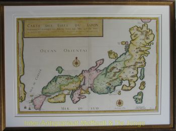
    Covens and Mortier (1721 - c. 1862) foi uma editora de Amsterdã, sucessora do extenso império editorial construído por Pierre Mortier (1661 - 1711).

    O mapa de Covens e Mortier é frequentemente criticado como derivado - mas este não é totalmente o caso. Pierre Mortier viveu em Paris de 1681 a 1685. Lá ele estabeleceu relações estreitas com os maiores cartógrafos franceses da época, incluindo De L'Isle e D'Anville.

    Seu modelo de negócios foi baseado em alavancar a tecnologia de impressão holandesa e sofisticação para co-publicar cartografia francesa de última geração. Após a morte de Mortier em 1711, sua empresa foi assumida por seu filho, Cornelius Mortier (1699 - 1783). Cornelius casou-se com a irmã de Johannes Covens (1697 - 1774) em 1721 e, em parceria com seu cunhado, fundou a firma Covens and Mortier.

    Sob a marca Covens and Mortier, Cornelius e Johannes continuaram no modelo de Pierre de publicar as obras francesas mais atualizadas com permissão. Eles rapidamente se tornaram uma das maiores e mais prolíficas editoras holandesas do século XVIII.

    A empresa e seus sucessores publicaram milhares de mapas ao longo de um período de 120 anos, de 1721 a meados do século XIX. Durante sua longa vida, a firma Covens and Mortier publicou como Covens and Mortier (1721 - 1778), J. Covens and Son (1778 - 94) e Mortier, Covens and Son (1794 - c. 1862).

Você está interessado em comprar esta obra de arte?

Artwork details