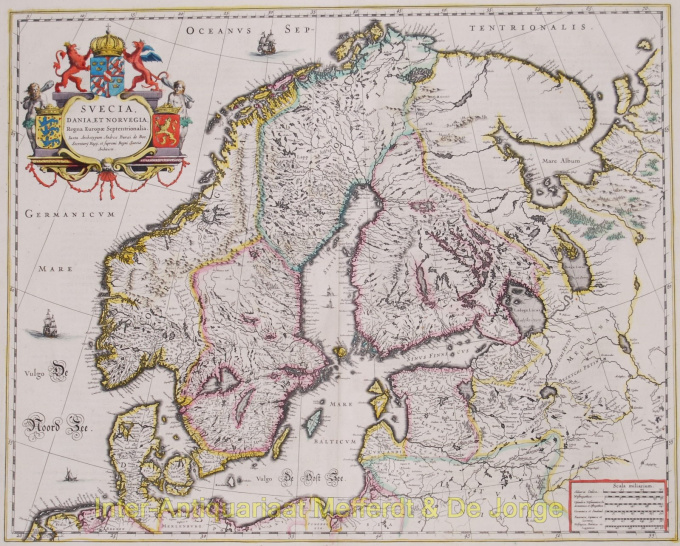
Scandinavie 1643 - 1650
Willem Janszoon Blaeu
Actuellement indisponible via Gallerease
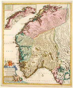
- Sur l'oeuvre d'artSuecia, Dania, et Norvegia, Regna Europae Septentrionalia Copper engraving published by the house of Blaeu, between 1643-50. Verso: French text. With original hand colouring. Size: 42,7 x 53,1 cm. This fine map depicts the kingdoms of Sweden, Denmark and Norway, whose coats of arms are featured within the title cartouche. The map is attributed to Anders Bure (1571-1646), a Swedish cartographer and mathematician. Bure, also known as Andreas Bureus, compiled a map of the northern part of Sweden and the first separately printed map of the country. Bure was an important figure in the history of Swedish cartography and set up a land surveying office which continued for over 200 years. The Kingdom of Sweden is shown at its largest extent. The map extends to present day Finland and the Baltic states, and is filled with details of towns, political boundaries, rivers, and topography. Price: Euro850,-
- Sur l'artiste
"Willem Janszoon Blaeu et son fils Joan ont incarné "l'âge d'or" de la cartographie néerlandaise. Travaillant au XVIIe siècle, Willem Blaeu a dessiné un certain nombre de cartes révolutionnaires et publié le premier atlas.
Il est né en 1571 à Amsterdam et a d'abord travaillé comme commis dans le commerce familial du hareng. Cependant, il n'était pas satisfait de son occupation et quitta la maison en 1594 pour étudier les mathématiques avec Tycho Brahe, le célèbre astronome. Blaeu était un bon élève qui impressionnait beaucoup son tuteur, et quand ses études furent terminées, il retourna à Amsterdam et s'installa comme cartographe. Son entreprise a prospéré et sa réputation a grandi. Il a été le premier cartographe à produire des cartes à feuille unique de nombreux pays européens.
En 1605, il a fait une carte murale du monde, englobant 20 feuilles, chacune de 8 pieds de diamètre. Cette carte était de loin la plus précise de l'époque et apporta une contribution remarquable à la connaissance de la géographie mondiale.
Sa carte est restée la plus précise jusqu'en 1648, lorsque son fils, Joan, qui est également devenu un célèbre cartographe, l'a mise à jour. Mais sa plus grande réalisation fut la production du premier atlas en 1630. Le nom Blaeu était en fait un surnom de famille que Willem prit après une confusion entre lui et son grand rival Joannes Jansonius.
Artwork details
Related artworks
- 1 - 4 / 9
- 1 - 4 / 24

